The
demise
of
an iconic
American
highway
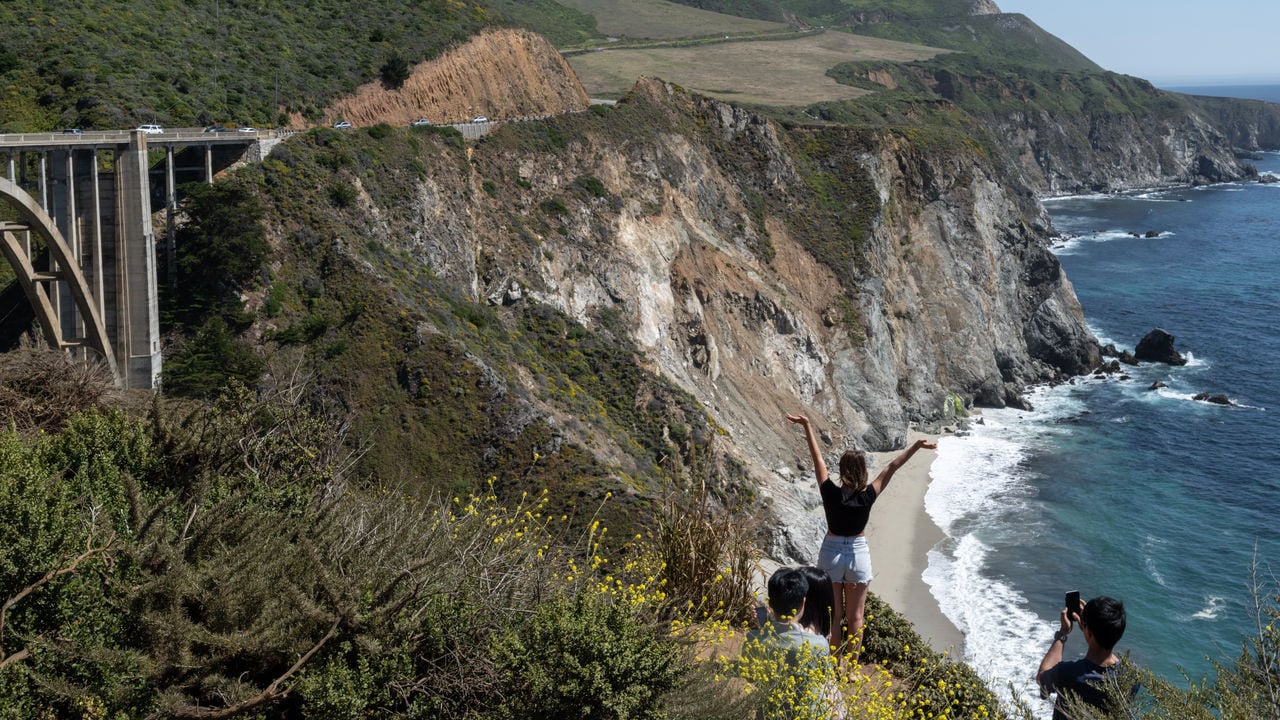
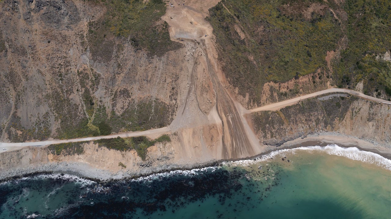
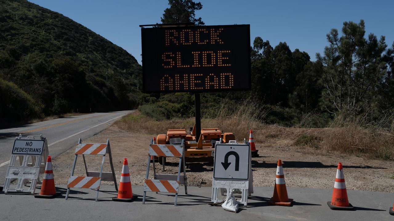
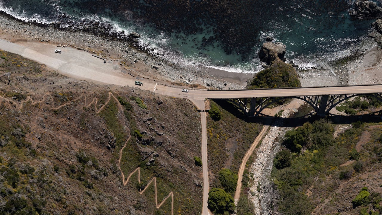
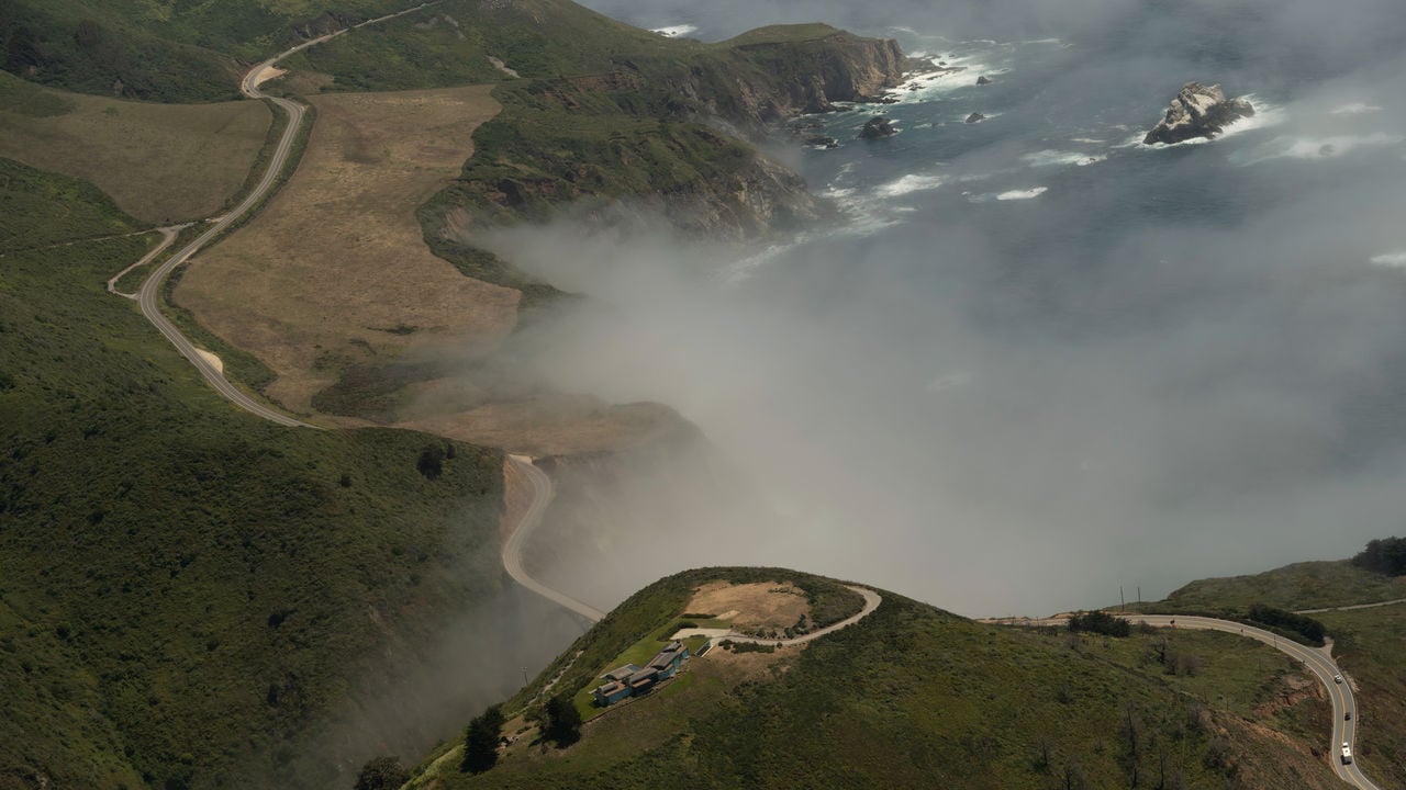
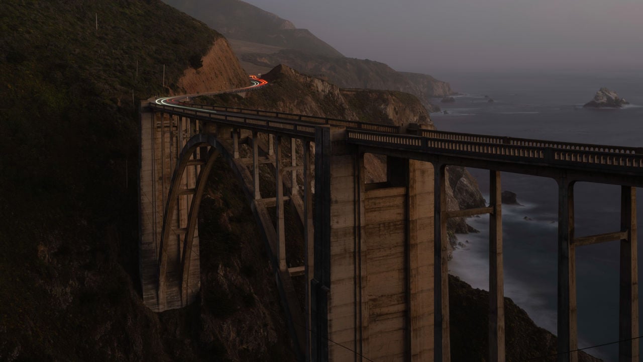
California's Highway 1 is showing
the limits of man's ingenuity
Bob Van Wagenen is cruising 2,000 feet above the rocky shoreline of California’s central coast at 180mph. The midday sun forces the fog to retreat westward from the cliffs and settle over the Pacific, allowing his four-seat Cessna Skylane a clear view of the bluffs below. He trades his aviator shades for spectacles to better read his instruments, and to look for blue whales in the azure waters. Two things stand out: the drama of the mountains meeting the sea, and the two-lane highway between them. “It’s terribly remote down here,” he says into his headset, the plane whirring in the background. “This is Highway 1 in all its glory.”
Highway 1 has many names. Roosevelt Highway. Pacific Coast Highway. Cabrillo Highway. It is the westernmost road in California, and it feels like it. Only a guardrail and a steady hand prevent drivers from careening into the ocean. It was proposed at the end of the 19th century, and construction began in 1919. But the 656-mile (1060km) route, which begins south of Los Angeles and ends in tiny Leggett, where redwood trees outnumber people, wasn’t finished until 1937. Built with prison labour, at least 70,000 pounds of dynamite and financing from Franklin Roosevelt’s Public Works Administration, it was one of many engineering marvels erected across America during the Depression.
California’s been good to me
Lately, however, the highway has not been traversable from beginning to end. Since January 2023, a Highway 1 roadtrip must be done in two pieces.
Tourists can cruise north along Orange County’s beaches, where the road first emerges from a tangle of highways resembling spaghetti. It swerves slightly inland in Los Angeles, before jutting back towards the coast.
Up near San Simeon road-trippers can smell the elephant seals before they come into view. The seals burp and bark and squirm in piles on the sand mere feet from Highway 1. Not all of the coast’s marvellous biodiversity is native to California. Zebras graze in the golden hills nearby, descendants of those William Randolph Hearst, a newspaper baron, brought to this corner of California in the 1920s.
Slightly farther north, the signs begin: “Slide area”; “Road closed ahead”.
Hope it don’t fall into the sea
The scenery is different at the other end. After traversing Leggett’s forests and the north coast’s craggy beaches, Highway 1 streaks across San Francisco’s Golden Gate Bridge.
South of Santa Cruz roadside shacks sell fresh strawberries from nearby fields. Sea otters play in the estuaries that surround the highway in Moss Landing. Humpback whales swim unseen in the submarine canyon just offshore.
South of Monterey, the signs begin again: “Rock slide ahead”.
Sometimes you’ve got to save yourself
Big Sur, a rugged 70-mile stretch of the coast over which Mr Van Wagenen is flying, is the highway’s missing middle. California’s fierce winter storms of the past two years pummelled the Santa Lucia mountains, loosening mounds of sediment which buried and broke the road in four places. Highway 1 is the only artery that connects Big Sur to the rest of California—and it was clogged.
Highway 1 has an unsolvable problem. The Santa Lucias are prone to heavy erosion, and climate change is making landslides even more likely. The highway’s health is important in its own right: for the people who live along it, the tourists who drive along it and the state that reaps the rewards of that tourism. But its slow demise exemplifies how climate change is upending infrastructure and threatening towns in precarious places.

Where the continent ends

Fog crawls up Big Sur’s western slopes, which are green in the winter months and gold in the summer. The redwoods cast long shadows above the poison oak. The mustard plant’s tiny yellow flowers are abundant. Without a reliable phone signal, locals navigate by waypoints. They speak about the land as a place eternal, with a reverence bordering on religion. “This is the California that men dreamed of years ago,” wrote Henry Miller, one of many writers and artists who sought solace in Big Sur. From the air, it looks untouched but for the highway. “It is like a giant has come down this coast with a huge sword and just cut the landscape with a big, gnarly scar,” says Magnus Toren, who runs the Henry Miller Memorial Library.
The highway has always been unstable because of the region’s geology. For more than 100m years the ocean’s crust plunged beneath the land that would become California. Bits of the sea floor—mud, the skeletons of microorganisms, chunks of lava, effluent from rivers—were scraped up as if by a snow plough. “There’s a whole pile of junk at the front edge of the continent,” explains Tanya Atwater, a geophysicist. Then, about 25m years ago, the collision of two tectonic plates pushed that “junk” skyward to form the Santa Lucia range. The mountains are crumbly and inconsistent: some material weaker than the rock right beside it.
“It’s a never-ending daydream or nightmare.” Magnus Toren at the Henry Miller Memorial Library in Big Sur
Because the mountains are relatively young, in geological time, they are still growing, and eroding. Mr Van Wagenen’s flights help track that erosion. Inside his plane is a camera connected to a GPS and a battery. When he hits a button, the camera starts clicking, taking one picture every second. Scientists at the United States Geological Survey stitch them into one continuous image. Using time-lapses they can compare the coast over time and try to catch landslides before they have catastrophic consequences. They have had some success with slow-moving slides. But the irregularity of the rock makes forecasting future debris flows impossible. “We’ve learned to be preppers,” says Kate Novoa, a long-time resident. “The road is going to close,” she adds. “The only question is, where, when, and for how long?”
Some of Big Sur’s 1,500 inhabitants welcome a break from selfie-taking tourists. Deer and coyotes reclaim the highway. Big Sur’s silence reasserts itself. But the respite comes with big problems. First responders can’t get to residents in an emergency. Ms Novoa takes care of her former partner, who has Alzheimer’s. Usually she can drive north from her home in Big Sur to take him to doctors at Stanford University. When the highway closed, the trip took more time and more money. Children must hike to their school bus. Helicopters drop food. Hotels and restaurants suffer. The state also loses. It is impossible to track the number of drivers on the road, but the central coast, parts of which can only be accessed by Highway 1, raked in $9bn in travel-related spending in 2023. Visit California, the state’s tourism agency, reckons that a 2017 slide deprived the state of at least $581m in tourism revenues and taxes.
“I call it the Tarmac Hilton.” Bob Van Wagenen with his plane and camera equipment
Climate change will make things worse. As the oceans warm, more moisture is carried in the atmosphere, which can create stronger atmospheric rivers. These conveyor belts for water in the sky now deliver up to half of California’s average annual rainfall. A recent paper from a trio of researchers at the University of California in Los Angeles (UCLA) suggests that the most extreme atmospheric rivers may deliver 25% more precipitation in future. When these filaments move east across the Pacific, the first landmass they hit are the coastal mountains, like those above Highway 1.
Climate change is also increasing the intensity and range of fires across California. Wildfires followed by more intense rainfall increase the risk of landslides. Flames can incinerate vegetation, destabilising soil and rock. When plants burn in extremely hot fires, a waxy, water-repellent substance can form and solidify on the soil. “It’s almost like putting a plastic tarp down on the ground in terms of letting all of that water run off,” explains Daniel Swain, a climate scientist at UCLA.

Stuck in the middle with you

Of the four slides that closed the highway since 2023, only one remains. The state’s transport agency, Caltrans, reckons the highway will open in full later this year. But there is no long-term plan to alter the road. Some propose grand solutions: tunnel through the mountains, or move the highway inland. John Laird, a state senator for Big Sur, shuts them down. “I get asked: ‘Why don’t you just reroute the highway?’,” he says, with some exasperation. “Sorry, have you been there? Have you seen it? When you have that situation, there is no rerouting.”
It ain’t like anywhere else
Locals believe that the highway is too precious to fail: that repair crews will arrive after every slide. They are probably right, but the price is high. Caltrans estimates that the four slides alone will cost $128m to fix. California is rich, but not exactly flush with cash. For the past two years the governor has slashed spending on climate initiatives to plug a budget deficit.
There are only whispers about the other option: managed retreat. Moving people from places vulnerable to climate change usually looks different. It is for communities in Louisiana or Alaska, in peril from rising waters. Big Sur will not be swallowed by the Pacific, but repeatedly being cut off from civilisation threatens the health and livelihoods of locals. Not fixing the road is “relegating those folks to not living there any more”, says Mr Swain. “Or living completely off the grid in a way that is not realistic for most people.”
Sitting in the corner of his library, with his cat, Jack Kerouac, mewing at his feet, Mr Toren ponders the wisdom of development in Big Sur—and its uncertain future. The highway brought us into this landscape, he says, with gratitude and remorse. But “if I were to deeply consider what would be best, then…we should all just leave Big Sur to be wild.”
Photos and Video: Kevin Cooley
Sources: Caltrans; Mapzen Terrain; Natural Earth; OpenStreetMap

Already have a subscription? Log in

Try The Economist for free

Unlock your free trial to continue

Explore all our independent journalism for free for one month. Cancel any time